
Strato Workflows for AWS-Based
Geospatial Data Processing
A self-hosted AWS-based tool for processing large geospatial datasets with automated workflows
Request a DemoA self-hosted AWS-based tool for processing large geospatial datasets with automated workflows
Request a DemoDrag and drop your custom algorithms to form scalable data processing pipelines.
Deployed entirely in your own AWS account so that your data and IP is never exposed.
We help you select cost-optimized compute services for your use case, while providing per-workflow cost breakdowns.
Trigger pipelines manually, based on file upload, a schedule, or an API request from other software.
Version control (Github), containerization (Docker); workflow change history tracked and structure exportable as Amazon States Language JSON.
Connect the Github repositories containing your custom algorithms to update workflows automatically with the latest versions.
Strato Workflows combines a web-based dashboard, GitHub integration, and deployment directly in your AWS account. We launch and configure it for you free of charge.
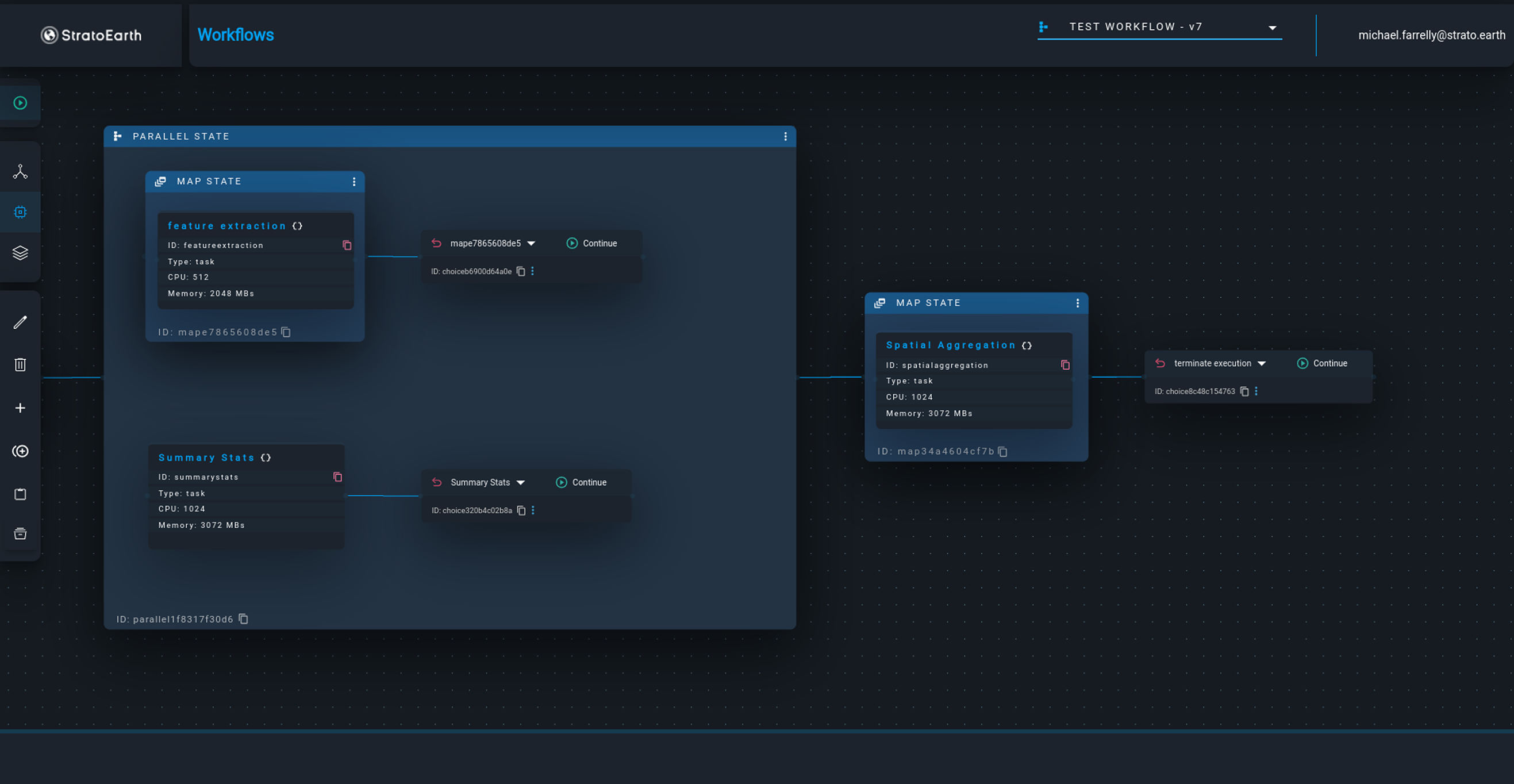
Use the visual workflow builder to define your processing pipeline. Connect data sources, processing steps, and output destinations using our drag-and-drop interface.
Trigger a workflow on file upload, manually, or via a schedule or API call.
We help you select between cost-optimized compute service options for each step of your workflow. Strato Workflows auto-scales to handle large datasets without manual resource management.
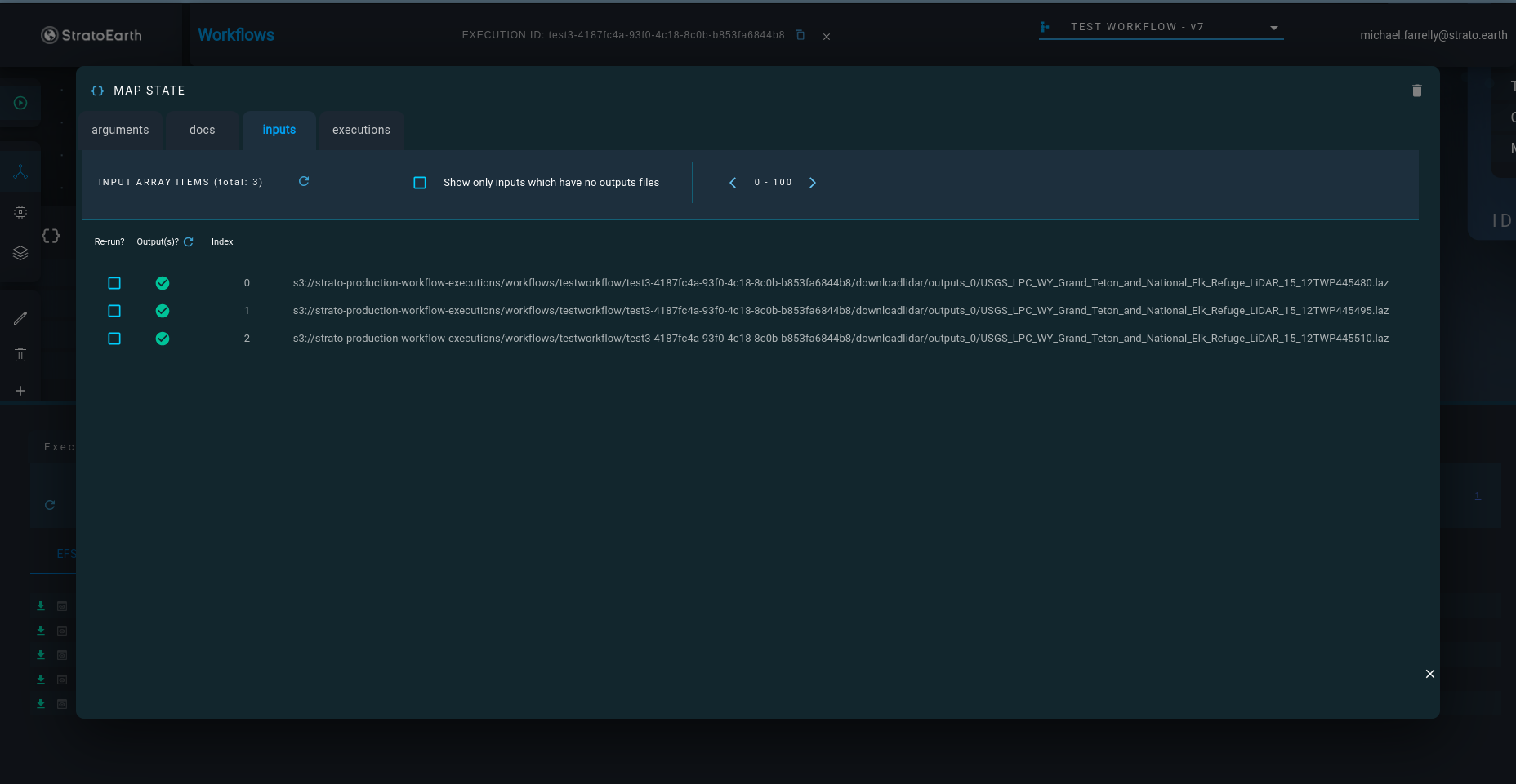
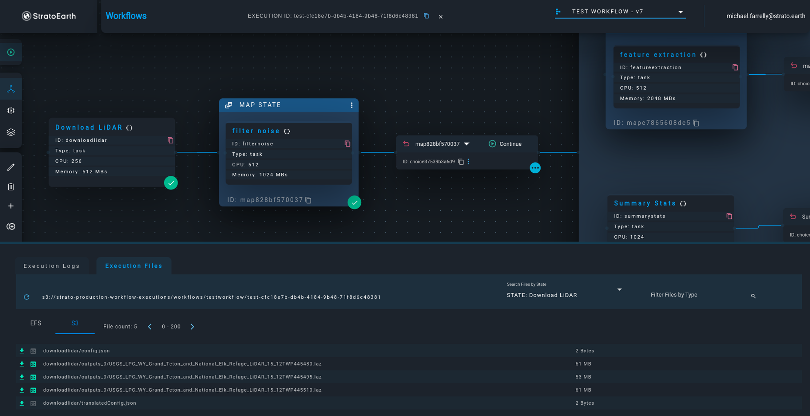
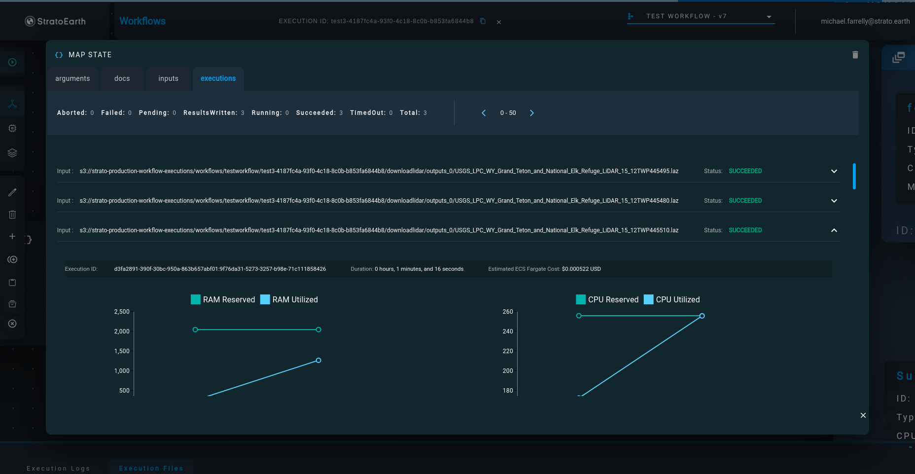
Track job progress, view logs, and monitor costs in real time. Alerts notify you of failures or anomalies before they impact downstream systems.
Processed outputs are stored in an S3 bucket of your choice, ready for visualization or internal/external sharing.
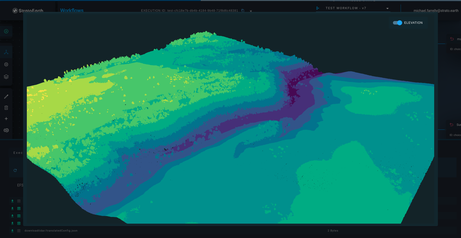
Strato Workflows is file format-agnostic, but with additional visualization and ingestion options for geospatial formats such as GeoTIFF, LAS/LAZ, Shapefile, GeoJSON.
No. All data is stored and processed within your own AWS account.
Yes. Strato Workflows exposes a REST API for triggering workflows from any external system.
Yes. Per-workflow cost estimates are shown before execution and actuals are reported after. You can set cost alerts and hard limits per pipeline.
No. Strato Workflows allows organizations to easily orchestrate their proprietary data processing algorithms into scalable cloud pipelines.